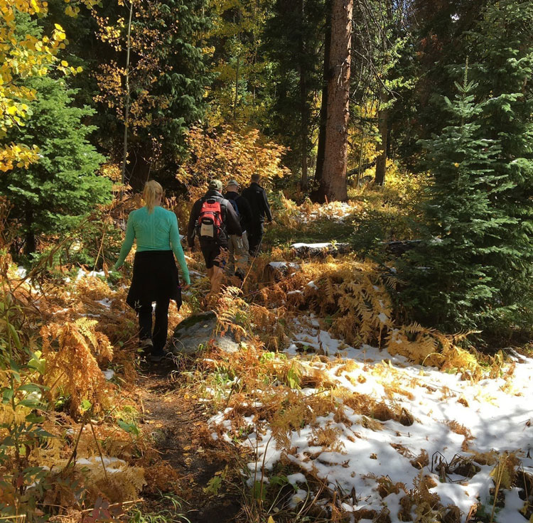
It’s the most wonderful time of the year—and no, we’re not talking about the holiday season yet. It’s finally fall! And with the change of seasons comes changing leaves throughout Colorado. Over the next week, we’ll get to see explosions of orange, red and yellow popping up all throughout our state’s foliage.
One of the best ways to enjoy our iconic fall colors is through a grand hike! Luckily, here in Colorado, we aren’t lacking in brilliant hiking trails. In fact, we’ve rounded up 40 of them. Whether you’re looking for a simple out-and-back trail through a meandering meadow or want to challenge yourself to a full-day trek over mountains—we promise there’s a hike offering breathtaking autumn views just for you on this list.
Note: The status of wildfires across the state has been changing frequently. We suggest checking the status and air quality in the area before you head out for the day! Have fun and stay safe!
Jump ahead:
Northern Colorado | Boulder | Jefferson County | Summit County | Eagle County | Aspen | Steamboat Springs | Telluride | Crested Butte | Gunnison | Southern Colorado
Northern Colorado
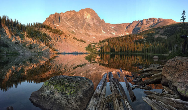
Fern Lake Trail
Hike Length: 3.4 to 9.8 miles round trip | Difficulty: Moderate
Located in Rocky Mountain National Park, the beginning of this trail is fairly easy and a good short hike for families. More ambitious hikers will want to continue on to the falls, where the trail climbs through the forest, offering beautiful, golden views of the trees and Fern Lake.
Lower Dadd Gulch Trail
Hike Length: 6 miles round trip | Difficulty: Moderate
This moderate trail is located in Arapahoe & Roosevelt National Forest and is split into two parts. We recommend taking the lower half, which is more of an easygoing, 6-mile, out-and-back hiking trail along the creek through colorful pines, aspens and rock outcrops.
Near Boulder
Big Bluestem Trail
Hike Length: 4.35 miles round trip | Difficulty: Easy
If you’re looking for a fall hike that offers great views and is less busy, don’t miss Big Bluestem Trail, which connects to the Mesa Trail. Rebuilt after the 2013 flood, this path traverses through prairie grasses putting on a fall show.
First Flatiron
Hike Length: 2.9 miles round trip | Difficulty: Moderate
While this trail probably isn’t on the top of most fall hikes lists, it is great for those looking to stay close to Denver and Boulder. This 2.9-mile hike is fairly difficult but the views across the Continental Divide make all the effort worth it.
Royal Arch Trail
Hike Length: 3.5 miles round trip | Difficulty: Hard
This trail at the heavily trafficked Chautauqua Trailhead is usually pretty busy. But if you start early, you’ll see why this trail to a red-rock arch is so popular. The hike is relatively short but climbs more than 1,300 feet in elevation. In the fall, cooler temperatures ease the ascent and offer a gold and red hue as a backdrop to the stunning Flatirons.
Near Jefferson County
Lair O’ The Bear Trail
Hike Length: 1.6 miles round trip | Difficulty: Easy
One of the best family hikes near Denver, this trail starts with a beautiful drive into the canyon on Bear Creek Road. Once you get to Lair O’ The Bear Park, you’ll find several great hiking trail options of various lengths and difficulties, but the shorter route along Bear Creek still offers great views during the autumn season.
Burro Loop Trail
Hike Length: 4.9 miles round trip | Difficulty: Moderate
This trail is another stunner in the heart of Golden Gate State Park near Golden. While it is usually fairly busy on the weekends, if you go during a weekday, you’ll be treated to peaceful views of yellow and orange aspens and a great view at the top of Windy Peak.
Black Bear and Horseshoe Loop
Hike Length: 5.4 miles round trip | Difficulty: Moderate
While Golden Gate State Park is only 30 miles west of Denver, it might as well be a different world. Not only are the trails pretty uncrowded this time of year, come fall, the colors transform the untouched scenery into a true golden paradise.
Mason Creek
Hike Length: 7.3 miles round trip | Difficulty: Moderate
This trail can be found in Colorado’s newest state park: Staunton State Park. Starting off in an open meadow with wide flat gravel paths, you should expect mountain bikers and dog walkers to join you on your hike. But as you get deeper into the park, you’ll be greeted by the sound of Mason Creek and aspen-filled forests.
Elk Falls Overlook
Hike Length: 10.8 miles round trip | Difficulty: Hard
Another hike located in Staunton State Park, this hike is less than an hour from Denver! This 10.8-mile roundtrip trek will be filled with changing aspens: yellow, orange and even red if you visit at the right time.
Near Summit County
Tenderfoot Mountain Trail
Hike Length: 2.6 miles round trip | Difficulty: Easy
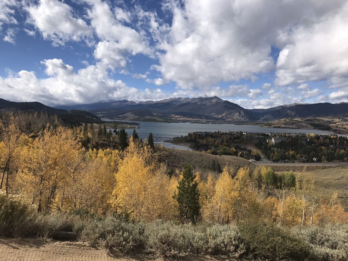
Perfect for all skill levels, this trail on Tenderfoot Mountain near Silverthorn offers postcard-worthy views across the Tenmile Range, Lake Dillon and the Gore Range.
Butler Gulch Trail
Hike Length: 5 miles round trip | Difficulty: Moderate
This trail, located just an hour outside of Denver, is open year-round for hiking or snowshoeing. But if you have the opportunity, don’t miss it during autumn! The long stretch of views, waterfalls and aspens turning among the green is worth the drive.
Bald Mountain
Hike Length: 10.3 miles round trip | Difficulty: Moderate
This popular trail is located near Breckenridge and can be pretty busy if you go during peak times. But if you find yourself there on a light traffic day, take advantage of the peace! We recommend driving up the mountain as far as you can—beware of the rough road—and finding a parking spot to hike the rest of the way.
Eccles Pass
Hike Length: 10.9 miles one way | Difficulty: Moderate
This challenging trek makes for a rewarding day out in the breathtaking terrain through aspen and pine forests and meadows. Leave a car at the start of Gore Creek Trail in Vail, then drive over to Frisco in another car to begin your journey at Meadow Creek. That way, after a full day of fall adventuring, you won’t have to do it all over again to get back to your car.
Hope Pass
Hike Length: 2.6 miles round trip | Difficulty: Hard
Hope Pass is a popular 2.6-mile trail with an elevation gain of 2,670 feet that takes you to Hope Pass. It’s usually run by participants training for the Leadville Trail 100 Foot Race but also offers plenty of fall fun for avid hikers.
Salmon and Willow Lakes
Hike Length: 16.6 miles round trip | Difficulty: Hard
The Salmon and Willow Lakes trail is a 16.6-mile lightly trafficked out-and-back trail near Silverthorn. Not only does it offer some great lake views, but you’ll also be treated to rugged, remote views of East Thorne, Red Peak and the iconic Zodiac Spires.
Near Eagle County
Piney River Falls
Hike Length: 5 miles round trip | Difficulty: Moderate
This 5-mile, round-trip journey is one of the many incredible ways to experience Vail’s fall foliage. It is an easy to moderate fall hike that finishes at the gentle cascade of Piney River Falls. To get there, head to Piney River Ranch in Vail. While the ranch itself is private property, there’s public parking available outside the entrance.
Overlook Trail
Hike Length: 6.2 miles round trip | Difficulty: Hard
This trail begins at the base of the Beaver Creek Ski Resort’s Centennial Express Lift and climbs about 2,000 feet to the Spruce Saddle Lodge. The final mile of the climb reveals sweeping views of the ski resort and peaks blanketed in changing aspens in the Sawatch Range.
New York Mountain Trail
Hike Length: 9.3 miles round trip | Difficulty: Hard
For a truly unique experience that also happens to give you a bird’s eye view of the changing aspens, hike New York Mountain. This route is fairly rough, but with aspen-laden hillsides nearby, it’s an excellent way to enjoy some fall scenery.
Near Aspen
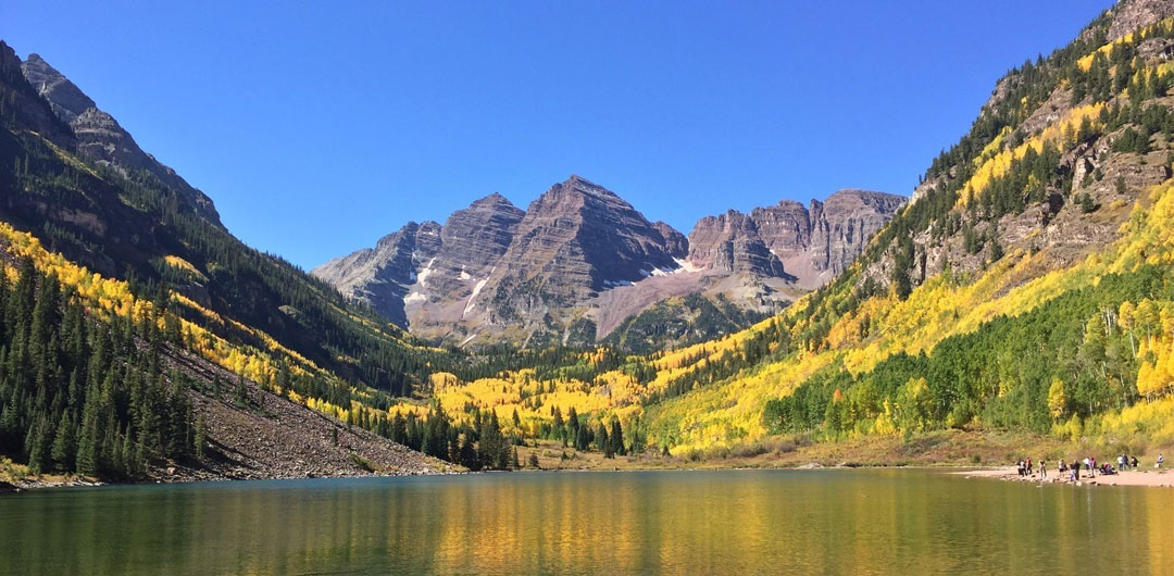
Maroon Lake
Hike Length: 3 miles round trip | Difficulty: Easy
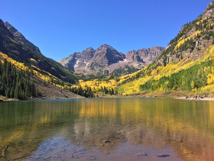
It just wouldn’t be a complete Colorado hiking guide without mentioning the famous Maroon Bells! The journey to Maroon Lake is an easy 3-mile hike, but it will be crowded. If you want to escape the bustling crowds, there are several less trafficked trails to explore past Maroon Lake too.
Ditch Trail
Hike Length: 4.3 miles round trip | Difficulty: Moderate
This lighter trail is a local favorite for morning or evening dog walks. It offers a flat start that cuts across the ski area on Snowmass Mountain. Before it ends, you’ll get views of Mount Daly and will have the option to continue deeper into the Maroon Bells-Snowmass Wilderness.
Tom Blake Trail
Hike Length: 8 miles round trip | Difficulty: Moderate
The Tom Blake trail is an out-and-back trail located in a place you would never really think of during this time of year—right on the outskirts of Snowmass Village Ski Resort. This hiking trail offers 360-degree views of gold, red and orange aspens and is an absolute must-visit every year.
Cathedral Lake Trail
Hike Length: 5.6 miles round trip | Difficulty: Hard
This local favorite is popular in the fall months for a good reason—it’s absolutely beautiful! It begins at 9,880 feet and gets gradually steeper and steeper for a final destination of Cathedral Lake, nestled at 11,866 feet at the base of the towering Cathedral Peak.
American Lake Trail
Hike Length: 6 miles round trip | Difficulty: Hard
Only a 15-minute drive from Aspen’s downtown core lies a trailhead in the Maroon Bells-Snowmass Wilderness that leads to one of the area’s most terrain-diverse day hikes. This popular autumn destination climbs around 2,000 feet before ending at the turquoise American Lake—a perfect destination for a picnic lunch and fishing!
Near Steamboat Springs
Three Island Lake Trail
Hike Length: 7 miles round trip | Difficulty: Moderate
This Steamboat favorite makes an excellent fall hiking trip. You’ll travel through a dense aspen forest that should be brimming with colors if you time it right! The trailhead can be hard to find, so just plug these coordinates into your Map app if you get lost: 40.76389, -106.70833.
Flash of Gold
Hike Length: 10.5 miles one way | Difficulty: Moderate
Steamboat might be known for its powder, but fall brings a noteworthy gold rush to the hills here. In season, the Flash of Gold is aptly named—it’s a trail lined with aspen groves starting at the Dry Lake parking area.
Spring Creek Trail
Hike Length: 10.5 miles round trip | Difficulty: Moderate
You’ll find the Spring Creek Trailhead at the corner of Amethyst Drive and Maple Street in Steamboat Springs. It’s an easy, meandering hiking trail that’s perfect for enjoying all the color displays this mountain town has to offer. But, as it is a bit long, don’t forget to bring plenty of snacks and water!
Rabbit Ears Peak
Hike Length: 5.5 miles round trip | Difficulty: Moderate
Rabbit Ears Peak Trail is a 5.5-mile heavily trafficked out-and-back trail near Steamboat Springs that will give you a great view of Rabbit Ears Peak, a unique rock outcropping that features gorgeous sights and plenty of jaw-dropping fall color.
Near Telluride
Yankee Boy Basin Trails
Hike Length: 2 to 11 miles round trip | Difficulty: Depends on Route
Choose your own adventure in Yankee Boy Basin! This area offers a ton of beautiful hikes, ranging from 2-11 miles round trip. No matter how far you decide to delve into the basin, we promise golden fall views and sounds of bubbling, blue waters.
Jud Wiebe Trail
Hike Length: 3 miles round trip | Difficulty: Moderate

It’s not hard to find good hiking near Telluride, given the surrounding San Juan Mountains. But if you’re looking for recommendations, you can’t go wrong with the Jud Wiebe Trail, a 3-mile loop that can be accessed from two spots in town and offers a steady, steep trek through aspen groves.
Lizard Head
Hike Length: 4.5 miles round trip | Difficulty: Hard
Lizard Head Trail is one of the most popular trails in Telluride all year long, but autumn is when it really shines. You have a number of trip options, one being a 7.6-mile round-trip journey to Black Face Peak. It’s a pretty difficult hike, so be sure to take a lot of photo breaks to help catch your breath!
Near Crested Butte
Tony’s Trail
Hike Length: 2.8 miles round trip | Difficulty: Easy
Tony’s Trail is an autumn favorite among Crested Butte residents for its easy, gradual climb and quiet Colorado views. For a more difficult trek, check out the Deli Loop nearby, which is 7.1 miles long and climbs about 650 feet.
401 Trail
Hike Length: 15.4 miles round trip | Difficulty: Moderate
There’s no parking near this trailhead, so you’ll either need to hitch a ride or plan to trek uphill about 2 miles on Gothic Road to this iconic trail. From the pass (10,707 feet), the trail climbs about 2 miles to an open alpine meadow high above the treeline with stunning views of the surrounding peaks.
Kebler Pass
Hike Length: 4.5 miles round trip | Difficulty: Hard
Kebler Pass isn’t technically a trail, but because the fall views and foliage are so amazing, we just had to include it! To get there, drive down Kebler Pass Road traveling west for 4.6 miles and park near the ravine. Hike on the left side of the stream and take in the autumn leaves. Once you’re at the top of Gunsight Pass, return via the same route.
Near Gunnison
Ptarmigan Lake
Hike Length: 6 miles round trip | Difficulty: Moderate
If you’re looking for those majestic mountain views without the crowds, make your way to Ptarmigan Lake. The trail itself is moderate, passing by several lakes along the way. We recommend visiting this one at the end of October to try to catch an early snowfall—the bright fall colors contrasting with the snow-dusted peaks is a real treat!
The Dyke Trail
Hike Length: 13.9 miles round trip | Difficulty: Hard
This difficult 13.9-mile loop is a favorite in the Crested Butte and Gunnison area. During autumn, the aspens will be brilliant, and the views of the Ruby Range and Anthracite Mountains don’t hurt, either.
Segment 4 of the Colorado Trail
Hike Length: 15.6 miles one way | Difficulty: Hard
Every year, hundreds of people pack the Colorado Trail to get a look at those stunning aspens. The majority of the crowds head to Segment 5 and 6 of the trail, so if you’re looking to get those aspen views with a side of peace and quiet, head to Segment 4, a tough but rewarding hike that gains about 3,200 feet in elevation.
Southern Colorado
Rainbow Gulch Trail
Hike Length: 3.4 miles round trip | Difficulty: Easy
This lesser-known trail is located near Woodland Park, south of Denver. Great for all skill levels, this easy hike offers wooded forests in addition to the lake of Rampart Reservoir, which is abundant with Aspens and Evergreens.
Cheesman Ranch Loop
Hike Length: 5.7 miles round trip | Difficulty: Moderate
This stunning trail in Mueller State Park offers one of our favorite hikes on this list! The trail itself is fairly wide, giving you plenty of room to roam on foot, bike or even horseback. The route weaves in and out of aspen groves and meadows, offering up unobstructed green, orange and yellow views with a mountain backdrop.
Pancake Rocks
Hike Length: 6.2 miles round trip | Difficulty: Moderate
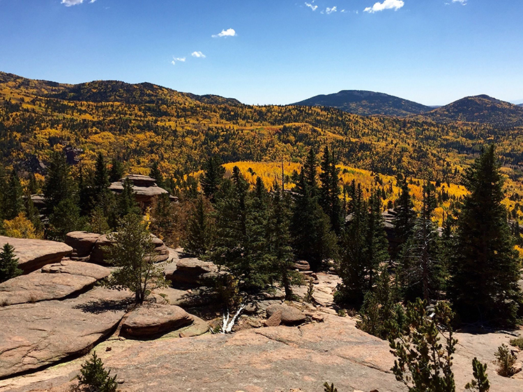
While the interesting rock formations along this trail are enough to draw hikers to the area all year long, it’s the gorgeous yellow and red scattered among the green that brings us here every fall.
Happy Hiking!
Did we miss your favorite fall hiking trails in Colorado? Let us know in the comments below!